Map of the parish of Wolverton
Map of the parish of Wolverton
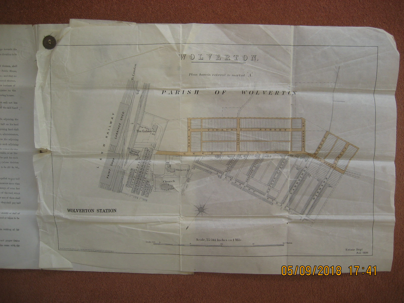
Map of the parish of Wolverton, dated 1899, drawn by the London and North Western Railway Company (LNWR). It extends from the Carriage Shed and Paint Shop in the east to Windsor Street in the west, and includes The Gables, the Church and the Vicarage. It also shows existing streets such as Aylesbury Street, Bedford Street, Oxford Street and Cambridge Street as well as the planned streets of Moon Street, Osborn Street and Victoria Street.
Contributor
Colin Mansell Brown
Reference number
CBR/004/004

No Comments
Add a comment about this page