Map of building land in Wolverton
Map of building land in Wolverton
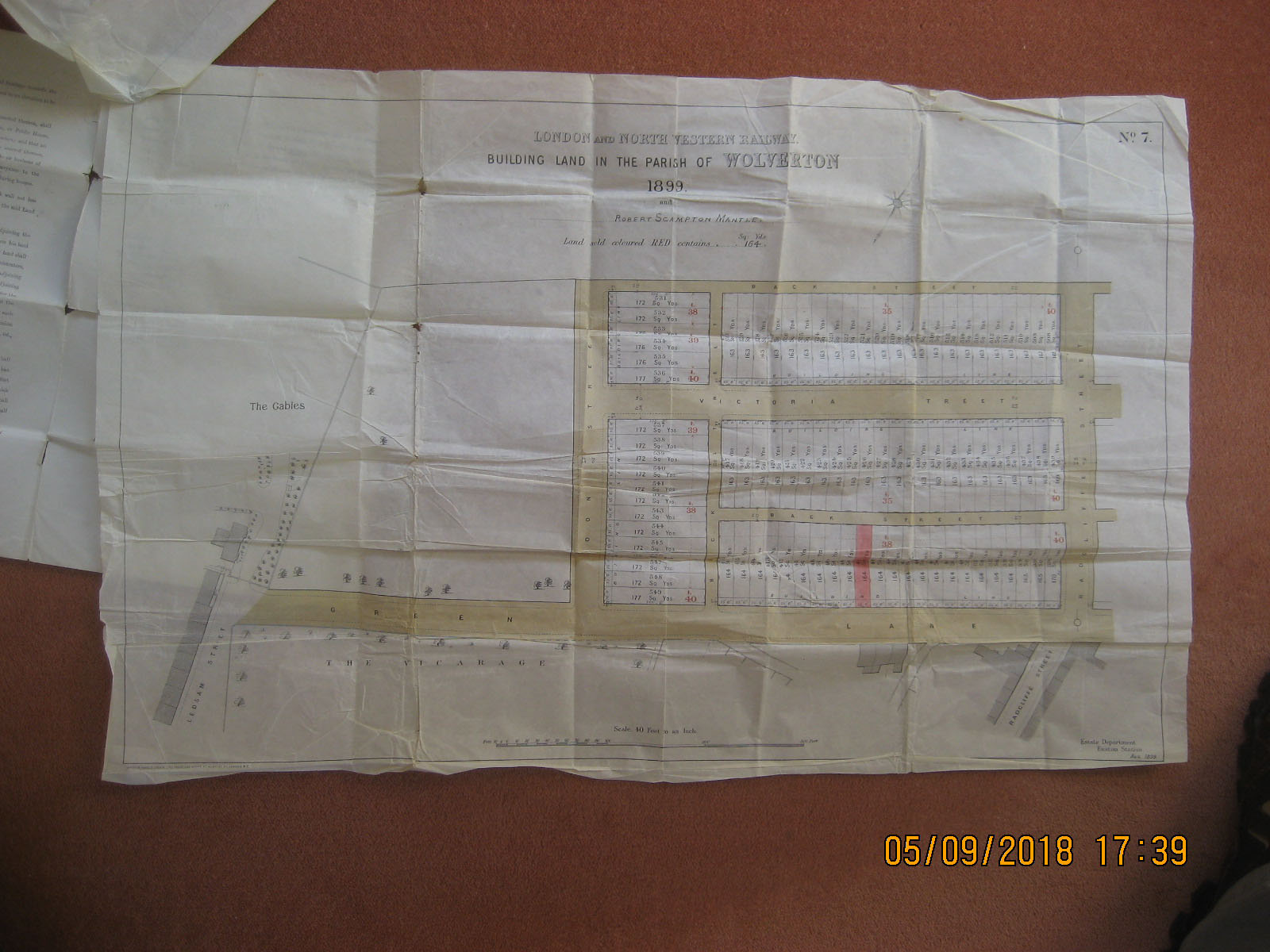
Map of building land in the parish of Wolverton, dated 1899, drawn by the London and North Western Railway Company (LNWR). The plots of building land are adjacent to Green Lane, Victoria Street and Moon Street. It is marked up in red to show the single plot for Robert Scampton Mantle.
Contributor
Colin Mansell Brown
Reference number
CBR/004/003

No Comments
Add a comment about this page