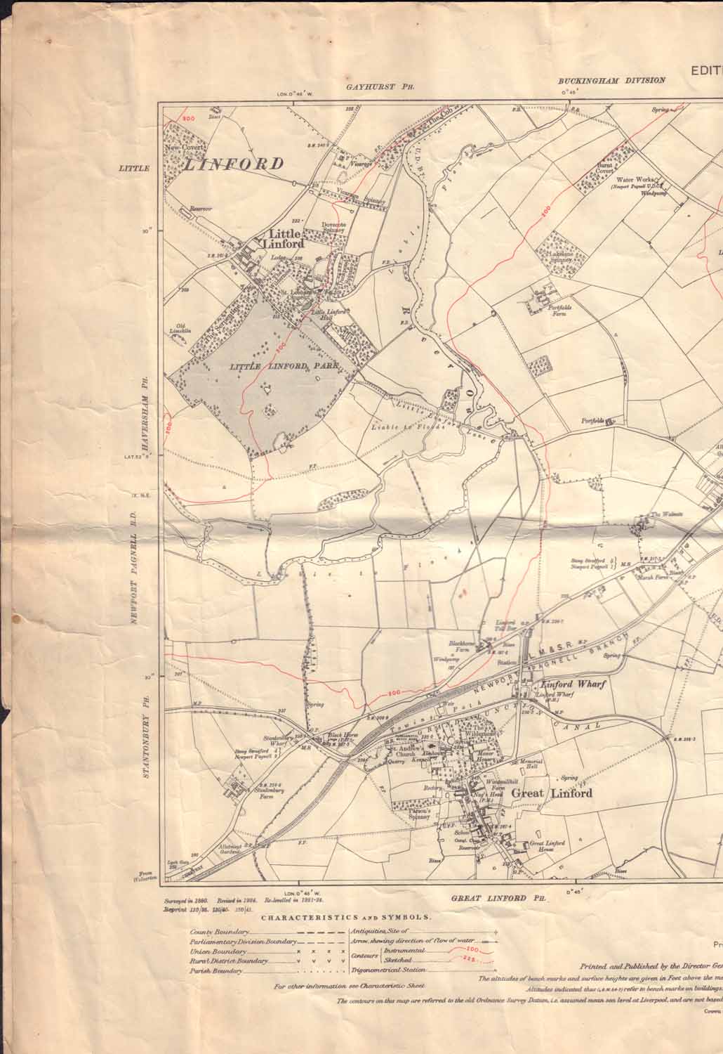
You are here: Home>Archive>David Kent Collection>Maps of Great Linford and area>1926 Ordnance Survey map of the Linfords 1926 Ordnance Survey map of the Linfords 1926 Ordnance Survey map of the Linfords Part of 1926 Ordnance Survey map showing Little Linford and Great Linford. Date of coverage 1926 Place Bucks, Great Linford Reference number DKC/002/005 No Comments Start the ball rolling by posting a comment on this page! Add a comment about this page Your email address will not be published. Required fields are marked *Your comment:Name * Email * Website Save my name, email, and website in this browser for the next time I comment. I consent to my name and e-mail address being stored along with this comment, and to the website editors communicating with me by e-mail about the comment if necessary. My name may be published alongside the comment on the website, but my e-mail address will not be published. My information will not be shared with any third party (see our Privacy Statement - opens in a new window). * Δ In this collection Our archive Collection: David Kent Collection Group: Maps of Great Linford and area Item: Two maps of The Mannor Of StantonItem: The upper map of The Mannor Of StantonItem: Enlargement of the upper map of The Mannor Of StantonItem: Map of Great Linford & manor estate from C17th originalItem: 1926 Ordnance Survey map of the LinfordsItem: 1926 Ordnance Survey map of Newport PagnellItem: Map of Great Linford Conservation Area Search the archive Text search Date search


No Comments
Add a comment about this page